Family Life
Henry Redman
This information was last updated in 2004. The Tudors have not changed, but our understanding of them might!
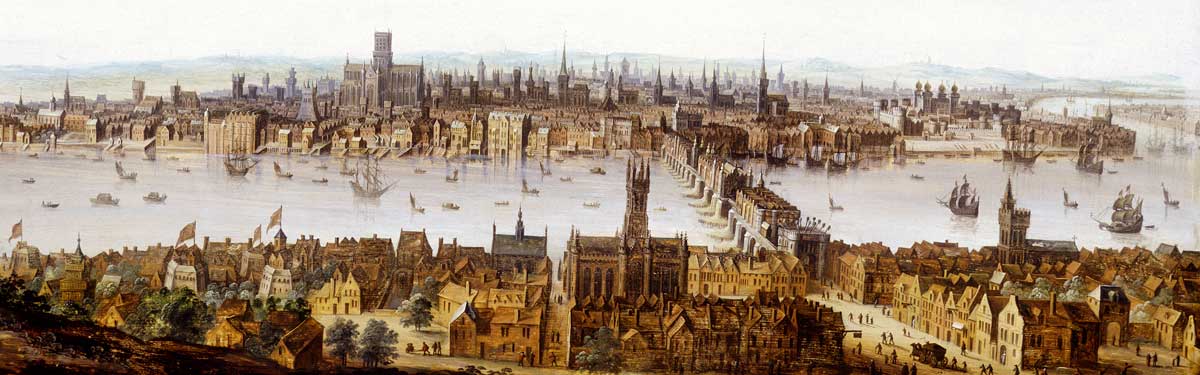
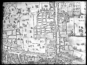
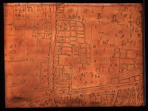
The map shows how crowded the City was. You can see part of the walls which surrounded it and Moor Gate with the limbs of traitors spiked on poles on the turrets. Their heads were mounted on London Bridge!
You can also see how Tudor Londoners worked and played in the fields north of the City. Laundresses sit by their baskets with their washing spread out to dry in the sun. Weavers have stretched out long sheets of cloth with pegs called tenterhooks. Young men are practising archery with bows and arrows, and people stroll along the lanes.
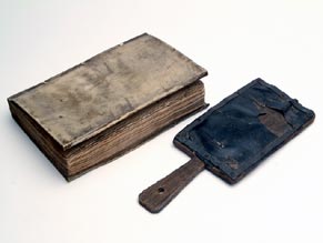
Maps were printed from engraved copper plates. First an artist made a drawing. Then an engraver copied it by cutting lines into a sheet of copper. The copper plate was then covered in ink and pressed onto paper. Many copies of the map could be printed from a single copper plate.
These plates are part of the earliest known map of London. Originally, there was probably a set of 15 plates, making up a much larger map showing the whole city. Two of the surviving plates are in the Museum, a third is in Germany.